









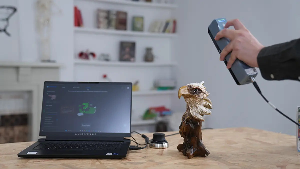
A point cloud is measured 3D data made of separate points in 3D space , not a finished surface, editable CAD model, or 3D-print-ready file. Each point usually records X, Y, and Z coordinates, so software knows where that spot sits on a real object or scene.
Think about scanning a machined bracket, a small sculpture, or an engine part. The scanner does not capture one perfect surface in a single step. Instead, it samples tiny locations across the object: an edge, a curve, a groove, a hole, a flat face. One point is just a dot. Put enough of them together, and a usable 3D shape starts to appear.
That is why point clouds are common in 3D scanning, LiDAR mapping, surveying, construction, reverse engineering, robotics, quality inspection, and computer vision. A 3D point cloud is often the first digital layer between a physical object and the mesh, CAD model, BIM reference, or measurement report you create from it.
What Data Does Each Point Contain?
At minimum, each point stores position. In many workflows, a point can store more than that.
| Point Data | What It Means | Why It Matters |
|---|---|---|
| X, Y, Z coordinates | The point’s position in 3D space | Defines shape, scale, and location |
| RGB color (optional) | Surface color values | Helps with visual recognition |
| Intensity | Strength of the returned signal | Useful in LiDAR and mapping workflows |
| Surface normals | Direction the surface faces | Helps with meshing and rendering |
| Classification | Labels such as ground or building | Useful in survey and GIS projects |
| Timestamp or viewpoint | Capture time or scanner position | Helpful for SLAM and mobile mapping |
Not every dataset contains all of these attributes. A simple XYZ file may include only coordinates, while richer point cloud data from LiDAR, robotics, or computer vision workflows may include intensity, normals, color, labels, or other fields.
Point Cloud vs Mesh vs CAD
A point cloud, mesh, and CAD model can all represent 3D shape, but they sit at different stages of the workflow.
Point cloud
A point cloud is measured 3D data. It is made of separate points, and each point records a position in space. Point clouds are useful for scan reference, measurement, as-built documentation, inspection, and reconstruction.
The main limitation is that the points are not automatically connected into a surface. A raw point cloud usually cannot be edited like CAD or sent directly to a 3D printer.
Mesh
A mesh is a surface model made from vertices, edges, and faces. In many 3D scanning workflows, the faces are triangles. When a point cloud is converted into a mesh, the software estimates how the points should connect to create a continuous surface.
Meshes are useful for 3D printing, visualization, texture display, AR/VR, digital art, and organic shapes. However, a mesh is not usually the same as editable engineering CAD.

CAD model
A CAD model is structured geometry used for design and manufacturing. It may include solids, surfaces, sketches, dimensions, constraints, holes, fillets, and editable features.
In reverse engineering, a point cloud or mesh often acts as the reference for building a CAD model. The CAD model is not just the scan in another format. It is a rebuilt model that reflects design intent.
| Data Type | Best For | Main Limitation |
|---|---|---|
| Point cloud | Measurement, scan reference, as-built data | Not a connected surface |
| Mesh | 3D printing, visualization, organic models | Not usually editable CAD |
| CAD model | Engineering design, manufacturing, simulation | Requires modeling decisions |
The term point cloud mesh can be confusing because it blends two different data types. A mesh can be created from a point cloud, but the two are not the same thing.
How Point Clouds Are Created
Point clouds can be created in several ways. The best method depends on the object size, surface material, required accuracy, lighting, working distance, and final use of the data.
3D Scanning
In 3D scanning, a scanner measures the surface of a real object or space. For object-level projects, a point cloud in 3D scanning is the measured surface data captured during the scan.
A product prototype, sculpture, automotive part, or human body scan may start as many surface points before the software aligns the data and prepares it for meshing, measurement, or CAD reference.
LiDAR Scanning
A LiDAR point cloud is created with Light Detection and Ranging. LiDAR systems send out laser pulses and measure the returning light to calculate distance.
When those distance measurements are combined with scan angle, position, and orientation data, they form a 3D point cloud. This is why LiDAR is widely used in surveying, mapping, construction, forestry, infrastructure inspection, and autonomous systems.
Photogrammetry
Photogrammetry uses overlapping photos instead of direct surface measurements from a scanner. The software matches visual features across images, estimates camera positions, and builds a point cloud or mesh from the image set.
It can work well for drone mapping, archaeology, cultural heritage, and textured objects, but it depends heavily on lighting, image overlap, and surface detail.
SLAM and Mobile Mapping
SLAM, short for Simultaneous Localization and Mapping, is common in mobile mapping. A SLAM system estimates where it is while building a map of the surrounding environment.
This makes it useful for indoor scanning, warehouses, factories, tunnels, underground spaces, and other places where GPS may be limited or unavailable.
What Are Point Clouds Used For?
Point clouds are useful because they preserve real-world shape in a measurable form. They are not just visual references. Used well, they help teams measure, compare, rebuild, inspect, and document physical objects or spaces.
Measurement and As-Built Documentation
In architecture, engineering, and construction, point clouds are often used for as-built documentation. A building, factory floor, industrial plant, bridge, or job site can be captured as 3D data and used as a reference for renovation, coordination, BIM modeling, or clash checking.
A point cloud survey works in a similar way. LiDAR, drone photogrammetry, or other capture tools generate 3D point data for terrain, structures, stockpiles, roads, buildings, or construction sites. The point cloud can support sections, volume calculations, mapping, and site records.
3D Modeling and Mesh Reconstruction
Point clouds are also a common starting point for 3D modeling. If you need a visible surface, the point cloud is usually cleaned, aligned, and converted into a mesh.
If you need to know how to create a 3D model from a point cloud, the basic workflow is: capture clean scan data, remove noise, reconstruct a mesh, repair the surface if needed, and export it in a format your next software can use.
Reverse Engineering and CAD
In product design and reverse engineering, point clouds help capture existing objects. A designer might scan a broken part, legacy component, handmade prototype, or organic shape, then use the point cloud as a reference for CAD modeling.
The key is that a point cloud is not CAD. It captures what exists. CAD rebuilds that shape into editable geometry with planes, curves, holes, fillets, dimensions, and design intent.

Inspection and Quality Control
In quality control, point clouds can be compared with CAD models to check deviation. This can reveal warping, shrinkage, deformation, assembly issues, surface variation, or areas that fall outside tolerance.
A scan may look dense and impressive, but density is not the same as accuracy. Scanner calibration, alignment quality, surface condition, operator technique, and validation all affect whether the result can be trusted.
Digital Twins, Mapping, and Simulation
Point clouds are also used in digital twins, mapping, and simulation. A scanned building, factory, road, mine, forest, or infrastructure site can become a spatial reference for planning, monitoring, training, or analysis.
In computer vision, a point cloud in 3D data gives software spatial information about depth, shape, position, and scene layout. That is why point clouds are useful in robotics, navigation, object detection, obstacle avoidance, and 3D reconstruction.
Common Point Cloud File Formats
A point cloud file stores 3D point data in a format that software can read, display, process, or exchange. There is no single best format for every project. The right choice depends on your scanner, software, file size, industry, and what you plan to do with the data next.
| Format | Common Use | Notes |
|---|---|---|
| PLY | 3D scanning, graphics, research | Can store point or mesh data, often with color |
| XYZ | Basic coordinate exchange | Simple and easy to inspect, but large text files can be slow |
| LAS | LiDAR, GIS, surveying | Common format for geospatial and LiDAR point cloud data |
| LAZ | Compressed LAS | Useful when LiDAR files need to be smaller and easier to share |
| E57 | Reality capture exchange | Can store 3D point data, attributes, and 2D imagery |
| PTS | Laser scan export | Simple text-based point data, but files can become very large |
| PCD | Robotics and research | Common in Point Cloud Library and computer vision workflows |
For basic coordinate exchange, XYZ may be enough. For LiDAR or GIS work, LAS and LAZ are common choices. For laser scanning and reality-capture exchange, E57 is often useful because it can carry point data, attributes, and imagery.
For Autodesk workflows, Revit and AutoCAD commonly use indexed point cloud formats such as RCP and RCS. A point cloud in AutoCAD is usually attached to a drawing as a real-world reference, while a point cloud in Revit is typically linked into a project to represent existing site or building conditions. In both cases, the point cloud can guide modeling, but it does not automatically become editable CAD or BIM elements.
How Point Cloud Processing Works
A raw point cloud is rarely ready for final use. A clear workflow makes the data more useful for measurement, meshing, CAD, BIM, or inspection.
Step 1: Capture the Point Cloud
Start with the right capture setup. A small mechanical part, a human body, a room, and a construction site all need different scanning strategies.
Object size, surface finish, required detail, working distance, lighting, and tracking method can all affect the result.
Step 2: Register and Clean the Data
If the object or site is captured from multiple angles or scan positions, those scans need to be aligned into one coordinate system. This process is called registration.
This is also where unwanted points are removed, such as background surfaces, stray reflections, table surfaces, scanning noise, or floating outliers. Clean, well-aligned data improves measurement, mesh generation, and CAD reconstruction.
Step 3: Reduce or Classify Points
Large point clouds can slow down software. Downsampling reduces the number of points while trying to preserve the useful shape.
In LiDAR and GIS workflows, classification may also label points as ground, vegetation, buildings, water, or noise.
Step 4: Convert Point Cloud to Mesh or CAD
If you need a visual or 3D-printable surface, convert the point cloud into a mesh. This is one common path for how to create a 3D model from a point cloud.
If you need engineering geometry, use the point cloud or mesh as a reference for scan-to-CAD. For existing-condition work, the point cloud may stay as a BIM or CAD reference instead of becoming a finished model.
Step 5: Validate Accuracy
Before using point cloud data for engineering, inspection, or construction decisions, check scale, registration quality, known dimensions, control points, scanner calibration, and alignment.
A detailed-looking point cloud can still be wrong if the capture or processing was poor.
Common Point Cloud Mistakes
Even a good scan can turn into a frustrating file if the workflow is rushed. These mistakes often lead to messy data, unreliable measurements, or extra cleanup work.
Treating a Point Cloud as the Final Model
The biggest mistake is treating a point cloud as a finished model. Sometimes the point cloud itself is the right deliverable, especially for documentation or survey reference. But for 3D printing, reverse engineering, BIM modeling, product design, or inspection, it usually needs processing first.
Confusing Density with Accuracy
A dense point cloud contains many points, but accuracy means those points are close to the real geometry. More data does not automatically mean better data.
Ignoring Noise and Outliers
Point clouds often include background surfaces, reflections, table surfaces, tracking errors, or floating outliers. If those points are not removed, they can affect measurements, mesh generation, CAD reconstruction, and inspection results.
Using the Wrong Scanner for the Job
A scanner designed for large spaces may miss fine detail on a small part. A scanner designed for object scanning may not be practical for a building or construction site. Match the scanner to the subject size, surface type, working distance, and accuracy requirement.
Overlooking File Size and Software Performance
Point clouds can become very large, and capturing everything at maximum density can slow down software without improving the final model. This matters even more when a point cloud file needs to move between different software tools or team members.
FAQ
Still have a few practical questions? These answers cover what often comes up after you understand the basic idea of a point cloud.
Q1: Are All Point Clouds LiDAR?
No. A LiDAR point cloud is only one type of point cloud. Point clouds can also come from 3D scanners, photogrammetry, depth cameras, SLAM systems, and other 3D capture methods.
Q2: How to Visualize a Point Cloud?
To visualize a point cloud, you need software that can open and display the file. Depending on the format, that might be scanner software, CAD or BIM software, GIS tools, or a point cloud viewer. Once loaded, you can usually rotate, zoom, crop, measure, and inspect the scan from different angles.
Q3: Is Point Cloud 2D or 3D?
A point cloud is normally 3D because each point has a position in three-dimensional space, usually X, Y, and Z coordinates. Some tools can show a 2D view, section, or projection, but the source data is still 3D.
Q4: Is Point Cloud Data Free?
Point cloud data is not free or paid by default. It depends on where the data comes from and what tools you use. Public datasets and open-source viewers may be free, while professional scanners, commercial datasets, and advanced processing software often require payment or a license.
Conclusion
In this guide, we’ve explained what is a point cloud: measured 3D data made of separate points in space. We also covered how point clouds are created, what each point can store, how point clouds differ from meshes and CAD models, and why processing matters before the data is used for measurement, inspection, BIM, reverse engineering, or 3D modeling.
For many users, the point cloud workflow starts with 3D scanning. If you need to capture real objects for product design, education, reverse engineering, or creative projects, a handheld 3D scanner can make the process more approachable. EINSTAR offers 3D scanning solutions with point-cloud and mesh-related export options, helping users move from physical objects to usable digital data with a clearer workflow.
Share:
3D Scanning vs Photogrammetry: Which Is Right for Your Project?
What Is Photogrammetry? Everything You Need to Know